
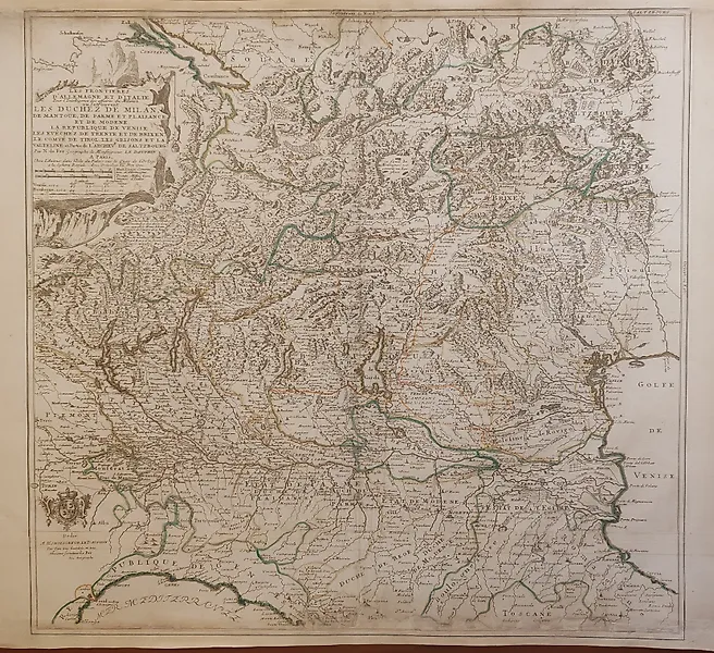
Italy - Milan, Italy, Lombardy, Monza; Nicolas de Fer - Les Environs de Milan - 1701-1720

The map "Les Environs de Milan" by Nicolas de Fer, created between 1701 and 1720, depicts the surroundings of Milan, a key city in northern Italy’s Lombardy region. Nicolas de Fer was a renowned French cartographer and geographer who specialized in detailed, decorative maps during the late 17th and early 18th centuries, a period when cartography was both a scientific endeavor and an art form. This map would illustrate not only the topography and road networks around Milan but also important towns, rivers, and possibly political boundaries relevant to the Duchy of Milan at the time. Milan served as a major cultural, political, and economic center in Europe, and its environs included fertile plains, strategic passes, and burgeoning towns. De Fer’s maps are recognized for their vivid colors, elaborate cartouches, and incorporation of contemporary geopolitical details, appealing both to officials and to collectors fascinated by European geography and urban development during the Baroque era.
VoxFati participates in various affiliate programs. When you click on links to different merchants on this site and take certain actions, such as making a purchase or signing up for a service, it may result in us earning a commission.



![Italy - "The Duchy of Mantua" : Eastern Lombardy, Mantua Province; Johannes Janssonius - Mantua Ducatus [Duché de Mantoue] - 1621-1650](https://assets.catawiki.com/image/cw_lot_card_ext/plain/assets/catawiki/assets/2026/9/30/a/3/a/a3adbe38-5b7e-457e-a664-faf2faa95786.jpg@webp)





Comments
Comments appear after approval.
Log in to comment